Tuesday 30 October 2012

Pamir Highway, part 2: Murghab to Osh

Even though it was late in the tourist season and there were few tourists because the Pamirs had been closed for a couple of months, Megi and I didn't have to wait long for a jeep from Murghab to Osh, as we obtained one leaving the morning after our first inquiries. Although we were supposed to leave well before 10:00, we spent a while waiting for additional passengers and then going to a few houses to pick up cargo, so it wasn't until after 11:00 that we actually hit the road.

The M41 leaves Murghab to the east and then curves north through a wide, flat valley, while another road continues straight east from Murghab towards the Chinese border at the Qolma pass.The first stretch of road, before the valley narrows and the road begins to climb the the Ak-Baital pass, runs through a wide, dry valley.

_DSC4048
Looking east, just north of Murghab.

_DSC4052
Barren but beautiful in the autumn sun.

_DSC4053
Smudges on the jeep's windows made it hard to take pictures. The road to Rang-kul lies through this gap in the mountains.

_DSC4055
The mountains close back in on the valley.

_DSC4059
A little further north the mountains have a bit more colour, as I saw from the mountain-top on the northern outskirts of Murghab.

Monday 29 October 2012

Murghab and the stark desolation of the high Pamirs

We arrived in Murghab after dark, and were dropped off in front of the hospital, which has to be one of the bigger buildings in Murghab. We went with our Pamiri friend to greet his colleagues, who offered us some dinner, including meat that they later said was Marco Polo sheep. Dwindling populations of these animals make them something you would really rather not eat, but it's also difficult to fault people who live in such a harsh environment for hunting animals.

After eating we were shown to the room where Megi and I would stay: a simply room with six single beds. These Soviet-era beds had woven steel springs underneath the mattresses, and age and wear had resulted in them being like hammocks with a mattress on top. Traditional-style tapchans on the floor would have been preferable. Although the hospital was a solid building built in Russian/Soviet style, the bathroom facilities were rather shocking. There was a large outhouse building located a few dozen meter north of the hospital, with separate men's and women's sides. There wwas no electricity or lights, so we had to bring our own flashlights. Inside, these were the dirtiest and smelliest facilities I saw on my trip. Although everything was concrete, the holes in the floor were surrounded by toilet paper and shit where people had missed their target in the dark. It didn't seem like anything was ever cleaned. Apparently the women's side was even worse. Hardly the sort of hygiene one would hope for in a hospital.

The next morning we split up and arranged to meet later at the Yak House, which is a tourist-oriented handicraft shop on the northeastern edge of town. Since META had folded earlier that year (but has since resumed operation), it was the center of tourism in the region. I headed down to the mosque and market area, those being the only real places of note in town.

_DSC3805
The Murghab mosque. Most of the high Pamirs east of the Koi-Tezek pass is ethnically Kyrgyz and therefore Sunni, for whom mosques are of relatively greater importance.

_DSC3809
Goats in the bumpy marshland in front of the mosque.

_DSC3812
A pair of kids were near the goats, though not exactly shepherding them.

_DSC3815
A foreigner with a camera? Let me get in on this action!

_DSC3821
The Aga Khan doesn't limit his aid to Ismailis, but helps the greater community (including the water pipeline I saw in Kyrgyzstan near Sary Tash). On the mountain to the left of the dome you can see a message of welcome to the Aga Khan spelt out in stones.

_DSC3820
The Aga Khan is also known as the Mawlana Hazar Imam, so I believe this is supposed to read "Welcome our Hazar Imam."

_DSC3822
A river and backwater eddies are south of the mosque.

_DSC3824
A brick and mortar yurt anchors one end of the market. Meat is sold inside. But what I really want to talk about in this picture is the blue plastic bag that old lady is carrying. It caries the logo of the "Aygen Collection," and it's the unofficial bag of Kyrgyzstan and Tajikistan. But although it looks like the bag of some sort of designer label or store—albeit one unintelligible to those who use it—it actually corresponds to no label or store known to Google. Instead, the label really describes the bag, and it's popular because it's a a relatively strong and reusable bag. You do have to pay for them, but they're everywhere. Apparently in the mid-90s the bag of choice in the region bore the logo of a Glascow pet store.

The ubiquitous bag photo-bombs an editorial photo illustrating drinks vendors in Kyrgyzstan.

Sunday 28 October 2012

Pamir Highway, Part 1: Khorog to Murghab

Megi and I were to meet in the morning at the market, where vehicles to Murghab leave. I arrived and wasn't able to find her, and after waiting around and periodically wandering down the main road to other places she might be waiting (we agreed to meet where vehicles leave, but it isn't always clear exactly where that is), I began to fear that she might have left before me for some reason. It turned out that she and the family she had been staying with had spent the night at a different house, and they had only returned relatively late in the morning. So it was pretty late by the time we were prepared to leave, and most of the vehicles had already left, but we found a Chinese-made minivan without too much difficulty, and were on our way before too much time had passed. We were stuck in the back seat with some cargo, and it was actually fairly comfortable because you don't have to worry about elbowing the cargo or slinging your legs over them.

Chinese minivans are popular on this route, as the road is decent enough for them not to be shaken apart, they hold a fair number of people, and they're dirt cheap: I think they cost something like $6,000. One of the other passengers in our van was a bright young girl of maybe 12 or so who was returning to her family in Murghab, and it was really charming to watch her talk with Megi and the other passengers, as she was absolutely nothing like the timid, downtrodden girls you see in the Fann mountains. She was bright and outgoing, and had no fear of challenging and disagreeing with the adult men in the van, let alone simply talking with them.She wasn't that happy to be returning to Murghab, however, as there simply wasn't enough there to be appealing to her

Megi had earlier told me about her taxi ride from Dushanbe to Khorog, where she had been similarly surprised at just how different Pamiri women were from the lowland Tajik women she was used to in Kulob. The women in her car showed no fear or hesitation to dominate and chide the men, telling her that in Pamiri families it is women who wear the pants in the family. This is so different than most of Central Asia, and Tajikistan in particular, but hugely refreshing, and a large part of the reason why Pamiris are my favourite people of Central Asia.

On the road to Murghab

For the first hour or so the M41 east of Khorog has scenery similar to the road between Khorog and Ishkashim, which is to say that it's relatively verdant with lots of trees and small villages. After a while, however, the valley rises and widens into a more desolate and rocky environment of the type we might expect to see in high-altitude mountain plains, rising to the deceptively high Koi-Tezek pass (4,272 meters high, even though the pass is not between close mountain but simply the crest of a long hill in the middle of a wide valley).

_DSC3740
Entering the high plains.

_DSC3741
Near the Koi-Tezek pass. Despite the snow, it feels like a desert and it's difficult to imagine that much vegetation grows in this stony valley, even in the summer.


_DSC3742
Mountains to the south.

_DSC3744
We came across a car stopped at the side of the road, and got out to stretch our legs while the drivers talked. It turns out the other car had run out of gas, so we gave him a ride to fetch some.

_DSC3746
The road is often washboard and bumpy, but isn't overly rocky.

_DSC3747
Chinese minivan in need of gas. Not the best place to get stranded.

_DSC3748
We dropped the driver here to get gas; I hope he found some. When I see a building with a gabled roof line, I imagine that it's a Soviet-era building constructed by the government. This may explain why it's abandoned.

Saturday 27 October 2012

Back in Khorog, via the border town of Ishkashim

In the morning we had breakfast and then settled up for our room and board. Aydar asked 50 somoni but was open to negotiation. Meggy thought this was a bit much, but given that official homestays cost that much for a bed and breakfast alone, I thought his price was quite fair, especially given that we each had our own room and there was a western toilet... and especially since it had been a rough year for tourism with the region closed for tourists for most of the peak season.
We ended up paying 50, and Aydar helped us find a ride into Ishkashim. There's a fort near Ishkashim, on a hill between the road and the Pyanj river, which many tourists stop at and which is somewhat known for being frequently occupied by Tajik border guards who don't take kindly to unannounced visitors, but since we weren't in a private car we didn't stop. Most of the excitement involved in stopping at this fort seems to center on interacting with the border guards, anyway, so I don't think it was any big loss.

Once we alighted in Ishkashim we first headed west of town to the location of the cross-border Saturday market to confirm it wasn't being held, then came back into town and explored the regular, daily market. The market was pretty basic, but we picked up some fruit and snacks. Ishkashim seemed like a pretty basic town, and in 2012 there were somewhat surprisingly no real places to stay there, even though it was the jumping-off place for exploring the Afghan Wakhan. And even though not a lot of tourists explore the Afghan side, there are plenty of traders and local who do cross over into Afghanistan (or vice-versa), so the lack of options is somewhat surprising.

_DSC3730
West of Ishkashim, near the Saturday market, looking towards Afghanistan.

_DSC3728
Cool bus stop. Does this mean they had proper bus services in the Soviet era?

_DSC3731
More Lenin, with some of Rahmon's words of wisdom on the walls behind.

_DSC3732
Interesting construction techniques: concrete supports on the lower level, stone walls, and rough wooden logs as floor and ceiling supports.

_DSC3733
Building new shops in Ishkashim's market area.

Strange happenings on the ride from Ishkashim to Khorog

We managed to find a car heading back to Khorog without too much difficulty. All of the other people in the SUV were young guys in their twenties, and out bags were stuffed in the back.

As we left town, we made a brief stop at a farmhouse just outside Ishkashim. These kinds of stops to pick up passengers and cargo are pretty normal, but this was a bit different, as we stopped about 100 meters from the house and they didn't want us to get out. The driver and his friend headed inside, then a couple of minutes later they came running back to the car, jumped in, and we immediately sped out of there. This is all very strange, as you never see anyone running, and usually no one is in a rush to get into a car (even if the driving is often quite manic). The concern was amplified when one of the guys in the rear seat started stuffing things into someone's bag—we couldn't see what he had r where he was putting it, but something was going on. 

Meggy and I exchanged slightly concerned glances, and we were both a little apprehensive when we reached the checkpoint between Ishkashim and Khorog, as we were both thinking that possibly these guys had picked up (or stolen) some drugs or other contraband and put them in our bags to help smuggle them through security. It turned out we had no problems at the checkpoint and there was certainly nothing removed from our bags before we left, so while the circumstances around that little stop remained a mystery, it was likely much more innocuous than we imagined. Or maybe not. 

Anyway, during the post-checkpoint ride to Khorog, we talked a bit with some of the guys, and it turns out that a couple of them were Afghanis from Afghanistan's Ishkashim who were studying and living in Khorog. I was a little surprised to hear this, as I kind of figured that Tajikistan would make things difficult for foreigners (from poorer countries) who wanted to live and study in Tajikistan, but apparently it isn't that uncommon in the region.

Back in Khorog

In Khorog we were dropped off at the taxi lot, and then decided to head over to the botanical gardens for the afternoon. Meggy was going to stay with the family she had stayed with the last time she was in Khorog (she had met a woman on her car ride from Dushanbe, and the woman had invited her to stay with her), so she went there while I headed back to Lalmo's. We met a half hour later, and took a marshrutka to the botanical garden, which is on the east side of town on a bluff south of the river overlooking the town.

I'm not quite sure what your typical botanical garden looks like, and October probably isn't prime viewing season, but this garden seemed to be mostly trees, with a path winding through it and a few picnic areas. On the south edge of the garden, overlooking the valley below, there is a large and impressive European-style house (currently undergoing renovation)—this building doesn't really have anything to do with the garden, but is one of the President's residences.

Behind the President's house is an orchard full of regularly planted apple trees, which were full of fruit when we were there. There was some fruit on the ground, and many apples which could easily be knocked loose by shaking the tree or throwing sticks up at branches.

_DSC3736
Khorog's botanical garden on the east edge of town. It's meant to be the second or third highest botanical garden in the world. It was pretty abandoned when we were there, but they had lots of trees full of ripe apples which we stocked up on.

After filling our pockets with apples, we returned to the President's house and headed down the grassy slope to the valley below, where we had spotted an interesting building near the river. It turned out to be a fancy chaikhana that was surrounded by a chain-link fence and locked up. I think it was used mainly during big events like Presidential visits and weddings. The guard came out to the entrance gate and after chatting with Meggy he let us in and gave us a brief tour of the exterior. It was impressive overkill: the sort of ostentatious but useless buildings you see being built in Dushanbe by people like Rahmon, and not the sort of functional infrastructure built in the Pamirs by the Aga Khan.

_DSC3739
The ornate and little-used chaikhana.

The weather in Khorog was disappointingly grey and cool, which only served to remind us how lucky we had been with the brilliantly sunny and warm weather we had enjoyed for the last few days. When I got back to Lalmo's she said that she had forgot to ask me if I wanted to eat there that evening, and when I said I did (it was dark and I didn't want to head down into town to find the Delhi Darbar Indian restaurant, which is pretty much the default option for travelers in Khorog) she was kind of pressured to whip something up on short notice. Reminder: always let her know in advance if you want dinner, as if she has notice she can make pretty great stuff.

Speaking of food, while walking to Lalmo's, I had encountered a young boy who offered me some food. I declined, and in doing so I think I committed a serious faux pas. As I said earlier, the Afghan market and the borders with Afghanistan were closed at this time for Eid al-Adha, which commemorates the willingness of Ibrahim/Abraham to sacrifice his son for God/Allah. Today, Muslims who can afford to do so commemorate Ibrahim's sacrifice by sacrificing their best animal, which they then divide into three portions for themselves, their neighbours, and the needy—and that distribution of food is what the boy was doing when I turned him down. This sort of community spirit is something I love about Islam: their religious holidays are still very much about the community and the less fortunate, and taking care of them. Ramadan is all about depriving yourself of food so you can understand how the hungry feel every day, and breaking the fast is about inviting the community to share in your food. Now think of the largest Christian holidays and what they mean (or don't). It's because I found the philosophy behind Ramadan so appealing that I started to observe Ramadan in my early twenties: it's a holiday that makes sense, unlike my equally secular historical observation of Christmas.

Budget

October 27, from Yamg to Khorog: 157 somoni
  • Taxi from Yamg to Ishkashim: 25 somoni
  • Taxi from Ishkashim to Khorog: 60 somoni
  • Room and dinner at Lalmo's: 72 somoni ($15)

Friday 26 October 2012

Another day in paradise: Yamg, Vrang, Yamchun Fort, and Bibi Fatima hotsprings

Leaving Langar

On my second morning in the Wakhan we got ready to leave Langar, and Megi's language skills came in handy once again. It turned out that one of Yodgor's relatives would be heading down the valley later in the morning, so we arranged to have him pick us up from the side of the road as we started ahead of him.

It was only while we were leaving that we discussed money with Yodgor, and when we asked him how much we owed him, he suggested 30 somoni per night–including breakfast and dinner–but said that if we thought this was too much we should say so. This is a screaming deal compared to prevailing rates at tourist-board-affiliated homestays—which are around $10 (45 somoni at the time) for a place to sleep, with meals adding another $5-$7 per day—so I was perfectly happy with his prices... and happy to recommend him to anyone staying in Langar. Of course the facilities are a bit more basic than at more tourist-oriented homestays (expect breakfast to be the shir choi that is a staple of local diet—bits of old, hard bread mixed with back tea, milk, and butter), but Yodgor is friendly and honest.

_DSC3542 - _DSC3555 2
Panorama of the Wakhan valley to the west of Langar.

_DSC3556
Tajik car seat. Rather like a 1970's western car seat, except the kid is way cuter. The car was a Lada Niva, which is like a 4-wheel-drive version of a 1970s VW Golf/Rabbit—a model which has been in continuous production since 1977. Just about every old car is equipped with an mp3 player that accept tiny micro-SD cards, and it can be comical to be bumping along horrific roads in an ancient vehicle driven by a rough and tough local who starts fumbling with a tiny little memory card between his fat, callused fingers when he decides to switch up the music.

We were dropped off in the village of Vrang, which is notable mainly for a five-level stepped pyramid which is usually described as a Buddhist stupa, but which some think may originally have been a Zoroastrian fire-worship platform—it definitely doesn't look like any other Buddhist stupa you're likely to see. Regardless of its original purpose, the structure was used for Buddhist purposes at some point in its history, and their are monks' caves built into the stupa's foundation—and apparently there are more caves on the other side of the Pyanj in Afghanistan, where a monastery was also located.

_DSC3557 - _DSC3562
We were dropped on the main road through Vrang, from which it is a short walk through the fields to the Buddhist or Zoroastrian stupa/pyramid on a salt-dome above the village.

_DSC3563
A Pamiri girl in the fields.

As we walked through the village towards the pyramid which towers over the village, Megi and I were approached by a girl of perhaps twelve who offered to show us the way and guide us around the village. This sort of thing is very common in Southeast Asian countries like Cambodia and Burma, where there are kids at local temples and caves who will tag along and show you the path or point things out with their flashlights, all in the hope of getting a tip at the end. I didn't know if this was the same sort of setup, but I suspected it might be, especially since the Lonely Planet section on Langar indicated people would expect to be paid for guiding you to the petroglyphs there. That being the case, I largely left Megi and the girl to walk together and chat, which was relatively easy to do since could talk pretty easily in Tajik.

_DSC3564
The best way to the pyramid is to curve around the base and enter from the side. This approach lets you take a look at the (inaccessible) Buddhist caves built into the pyramid's foundation, which you can see on the left.

_DSC3565 - _DSC3570 2
Panorama from above the pyramid, with the ruins of an old fort above the pyramid.

Thursday 25 October 2012

Welcome to the Wakhan: two nights in Langar

The eventful ride to Langar

After getting my visa I headed over to the taxi lot for Ishkashim and Langar. Walk through one of these lots and you'll be approached by people asking where you're going, and if you're lucky they'll either be going there or point you to someone who is. Then you start negotiating price, which can be tricky for locals and foreigners alike. The general rule is that you try to get to car lots as early as possible, although when traveling from a market town to nearby rural villages most cars leave after people have had a chance to shop at the market. Ishkashim itself is probably somewhere between the two options: it's lose enough that people may drive up to Khorog in the morning for the market, but it's also big enough that it has a decent market of its own. Langar is far enough away that no one would drive to Khorog just to do shopping, however.

Despite this, and despite my not leaving until the afternoon as a result of obtaining my Afghan visa in the morning, I was able to find a vehicle going all the way to Langar, for 100 somoni.

Of course, this being rural Central Asia, things are rarely as simple as they seem. Even though the car was full, we ended up making a stop at the nearby village of Dasht, which is just above the Khorog-Ishkashim road but utterly hidden from the valley below, so that we could pick up some cargo from one of the passengers' family. We ended up staying in Dasht for fifteen minutes or so, stopping at a couple of different houses before continuing on our way. Pretty standard stuff. One of the ladies returned from one of the houses with a big bag of apples which she shared with the car.

_DSC3339
Poplar-lined road in Dasht village, above the road to Ishkashim.

_DSC3342
Hay stacked precariously on the roof.

_DSC3341
Rooster just wandering around the village.

_DSC3345
A Tajik farmhouse, with Afghan mountains on the other side of the Pyanj river.

_DSC3347
Looking north down the Pyanj towards Khorog: Afghanistan on the left, Tajikistan on the right.

_DSC3349
Looking down the main street in Ishkashim, with the Hindu Kush in the background.

Tuesday 23 October 2012

One day in Khorog: an oasis of progressiveness


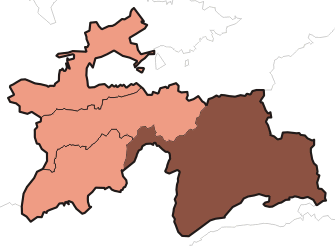
GBAO: the Gorno-Badakhshan Autonomous Oblast

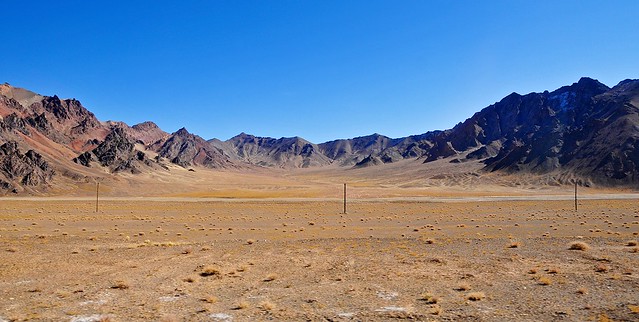
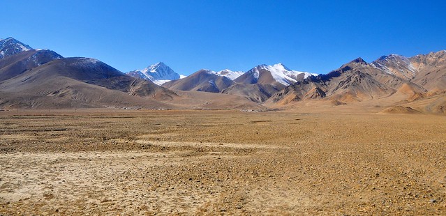
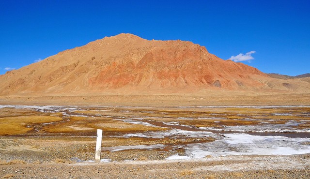
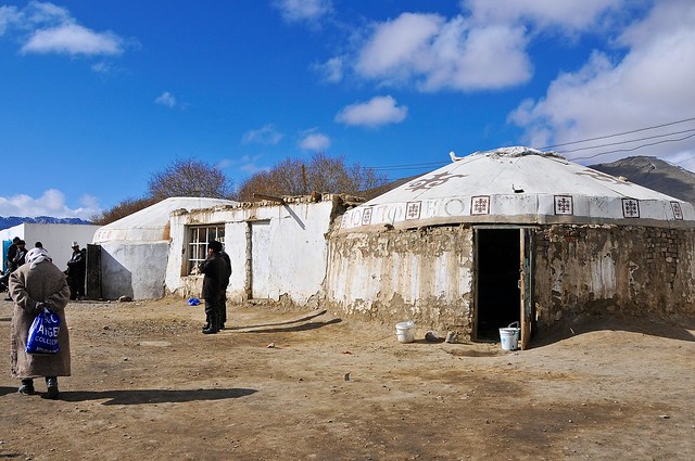
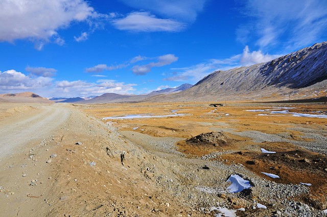
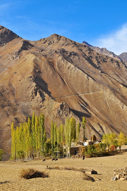
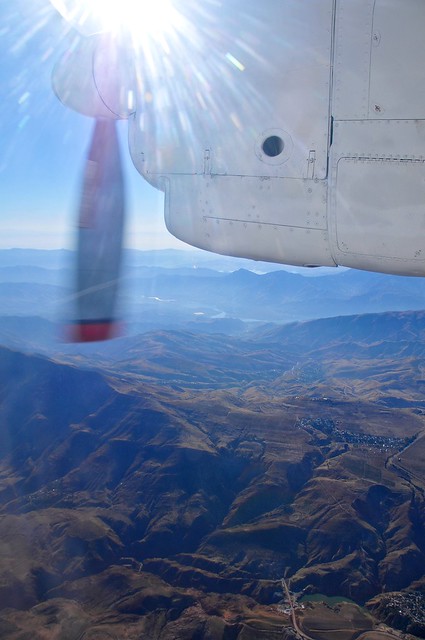
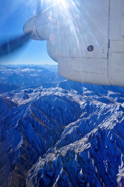
Basically all of the Pamirs and the entire southeastern knob of Tajikistan falls within the administrative region known as Gorno-Badakhshan. And if ever there was a part of the country that could be said to contain nothing but rocks and water, it would be the GBAO, which occupies 45% of Tajikistan but has only 220,000 people (about 3% of the population).


Pamiris are Ismaili Shias, while most Tajiks are Sunni

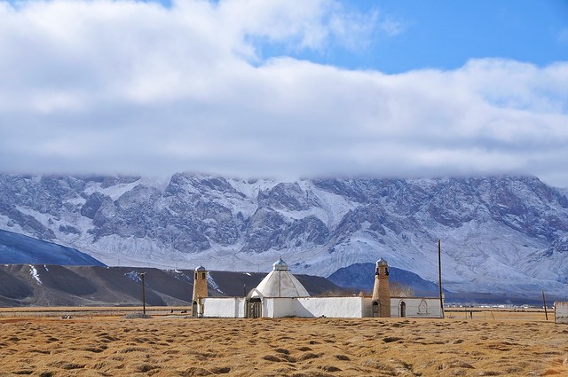
The region is not only geographically distinct, but ethnically and religiously as well. The northeastern part of the GBAO, along the Pamir Highway from the Kyrgyz border until at least Murghab, is mainly Kyrgyz, while the western GBAO and areas near Afghanistan (which are significantly lower, though still above 2,000 meters) are mainly Pamiri. Pamiris have their own languages, but like Dari and Tajik, these languages are minor variants of Farsi and seem to be mutually intelligible for the most part. The main point of distinction between Pamiris and the Tajik is religious: while lowland Tajiks are Sunni, like 90% of Muslims in the world, Pamiris are Shia—and more specifically, Ismaili (which are only 20% of Shias).

Attending university in Calgary, I knew quite a few Ismailis: we had a sizeable population of Gujarati Ismailis who worked as traders and settled in East Africa, but were then expelled from countries like Uganda after they gained independence (Indian merchants being convenient scapegoats). Many seem to have somehow made their way to Calgary. Indeed, the beloved mayor of Calgary, Naheed Nenshi, is an Ismaili Muslim of Tanzanian extraction.

So who are the Ismaili's? Well, here's an excerpt from a great piece on Ismaili Islam on Paul's Travel Blog:


The Tajik Pamirs and northern Pakistan share not only mountainous terrain and certain ethnic/cultural links but also religion: Ismaili Islam. The Ismailis are Shiite Muslims who believe that the true seventh Imam was a man named Ismail rather than his younger brother Musa, as the Twelver Shiites (such as those of Iran) believe. While during certain periods, such as the Cairo-based Fatimid Empire, Ismailis were a powerful force, today they form a small minority of Muslims, often scattered in remote mountainous terrain.

The historical distinction between Ismailis and other Shiites may seem minor, but, over time, this simple succession dispute has led to a universe of divergence, as Ismailis have become among the most progressive of the Islamic sects, in stark contrast to the Shiites of Iran. Indeed, the distinction between Ismailis and other Muslims has grown so great that one (Sunni) Kyrgyz woman in Tajikistan told us that the Tajik Pamiris were not even Muslim. Of course, despite the strong lingering of pre-Islamic beliefs and traditions the Ismaili Pamiris are in fact Muslim, as are the Ismaili Hunzas of northern Pakistan, but it is true that the Ismaili worldview of the twentieth and twenty-first centuries is clearly a world apart from some other sects of Islam, and, to this outsider, far more appealing.

Ismailis are also different from most other Muslims in that they have the Aga Khan as a living spiritual advisor, whom they see as a direct descendant of the seventh Imam, and more importantly they believe that he is able to interpret the Quran in the modern context. I suppose this might make him something like the Pope, but the Aga Khan is quite different than the Pope in that he is an extremely modern man (in this he more resembles the Dalai Lama), was born in Switzerland, and is something of a playboy. Imagine Tony Stark as the leader of a branch of Islam and you're not too far off. I mean, his parents were divorced and his father then married Rita Hayworth, which tells you a lot about his family and their values—especially given that his grandfather was the prior Aga Khan and passed on his duties to his grandson because he wanted even more modernity from the future leader.

The net effect of having a branch of Islam being led by this Swiss-born spiritual leader is that Ismailis are hugely progressive by the standards of just about any religion, and the hugely wealthy Aga Khan remains close to his followers and spend hundreds of millions of dollars per year through his Aga Khan Foundation and Aga Khan Development Network to advance the development of his people and their surrounding communities.

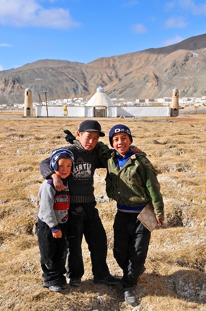
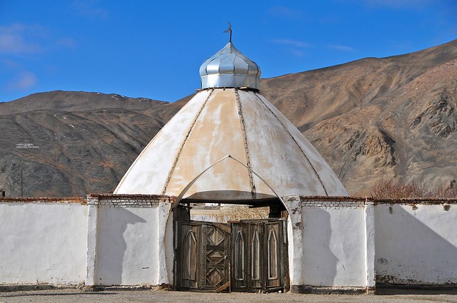
The impact of the Aga Khan and the magnitude of his contributions are most apparent in the GBAO—and in Khorog in particular—as so many of the things that make the town so special have been funded by the Aga Khan. From quite literally building bridges that connect communities and countries, to providing food aid during the civil war, to spending in the medical community, to providing education, to hearing people in the streets tell you that they do things (or don't do things, like drugs) because of the guidance of the Aga Khan. One area where you see a real difference is in how women are treated. Unlike in the ultra-conservative Fann Mountains, women play a real role in civil society and assume positions of leadership within families. Girls are not second-class citizens, women don't run away from even the most fleeting contact with men, and there seems to be no thought of denying them education because of their sex. It's no coincidence that the homestay I stayed at is known as Lalmo's homestay, and not Lalmo's husband's homestay: women are empowered to a startling degree.

The post-Independence Civil War

Now, in the paragraph above, I alluded to the civil war. Tajikistan is the only one of the Central Asian CIS countries that devolved into civil war following independence from the crumbling Soviet Union, and given the cultural and logistical differences between the GBAO and the rest of the country perhaps it's no surprise that Badakhshanis and the lowland Tajiks were on opposing sides... or that the lowlanders won.

The current President, Emomali Rahmon, came to power as a result of the civil war, and he has basically been the only leader that an independent Tajikistan has ever known. In the wake of the civil war it seems that Rahmon granted government positions to a number of warlords and opposition leaders in a attempt to placate them and ensure a measure of government support—something that was probably of special interest given the strategic importance of the GBAO given its long borders with China and especially Afghanistan.

Despite these concessions, there has been a long history of tensions between the Pamiris and lowland Tajiks. Part of this tensions is religious (many Tajiks think that Ismaili Islam isn't a pure or legitimate form of Islam, epsecially since it views the Quran as open to interpretation by the Aga Khan) and part of it is a resentment by the Pamiris that the government treats them unfavourably (you certainly hear people saying that there were better services during the Soviet era, and although you hear this in lots of former second-world countries, in the Pamirs I think there is the suspicion that the decline has been due to them being Pamiris and not lowland Tajiks). Virtually everyone in the GBAO will self-identify primarily as something other than Tajik, be it Kyrgyz or Pamiri.

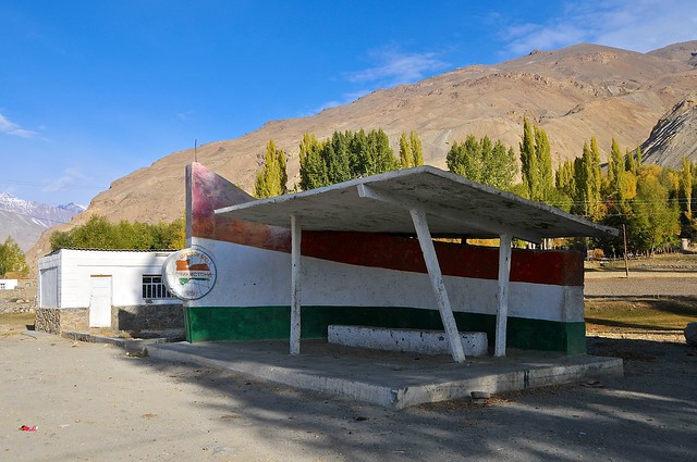
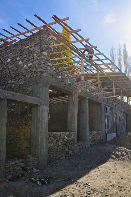
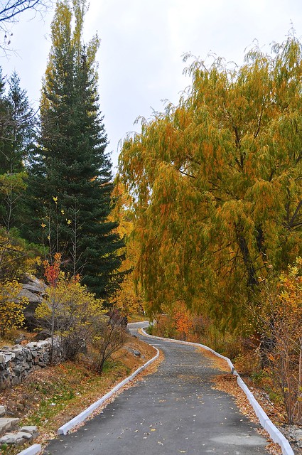
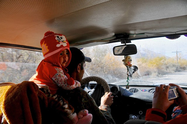
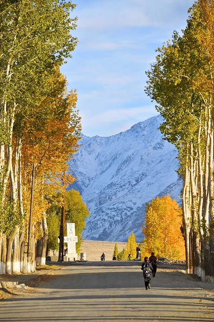
First impressions: walking from the Airport to Lalmo's

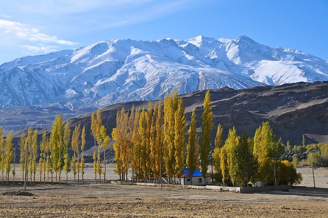
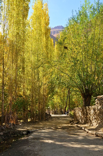
I don't know what I was expecting from Khorog. Something high and harsh, maybe. Small and rough. And definitely running north-south along the border with Afghanistan. On pretty much all fronts I was surprised. Although Khorog is at an elevation of over 2,100 meters, the town is surprisingly green and full of trees. And for late October, it was a lot warmer than I expected, and pleasant to walk around in the sun. Heck, this would be better weather than one would expect in Calgary, and the climate also supports a greater range of trees. Looking at weather profiles for Khorog, however, it seems like a remarkably temperate city, with the average high in October of 18°C (65°F)—only in January is the average high below freezing.

And despite the harrowing road journey from Dushanbe, Khorog didn't feel as isolated as I expected. The markets were well stocked—certainly much more so than I saw in Kyrgyz Alay Valley communities like Sary Mogul, Sary Tash, and Daroot Korgon. Maybe this shouldn't be so surprising, as it actually lies on the closest road to China, which would run through the Pamir border of Qolma before running through Murghab and Khorog on the way to Dushanbe.

Among the ubiquitous Chinese goods at the market there were some distinctly Pamiri items like huge and bulky socks and knitted toques ("knit cap" in American). Perhaps the only way the town revealed its isolation was in the food situation, as there didn't seem to be many restaurants.

_DSC3267
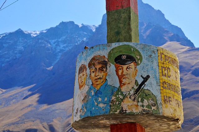
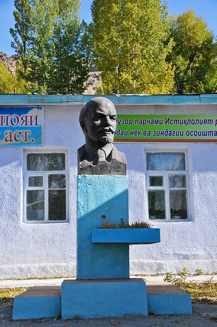
An  old Soviet-era social-realism style painting on a pole.

_DSC3268
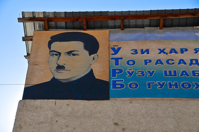
The "Hitler" look is apparently respectable in Tajikistan. Or maybe it demands respect. Or fear. Or something. Based on some things I later saw in Murghab, this guy appears to be some sort of government official.

_DSC3269
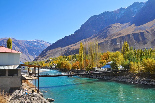
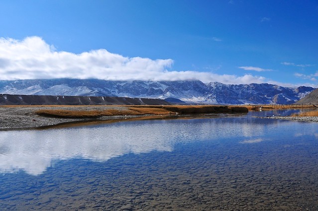
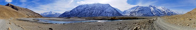
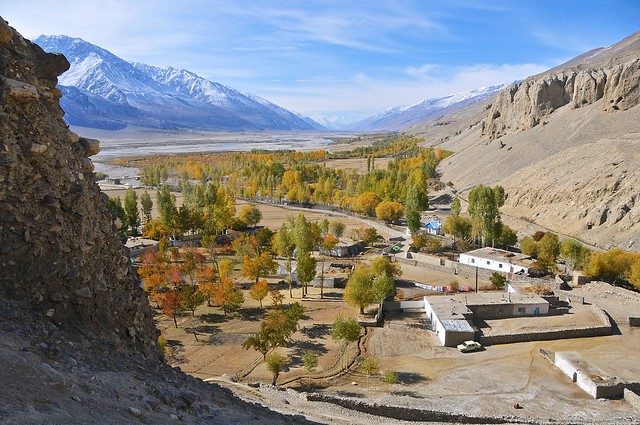
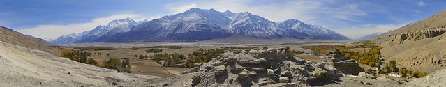
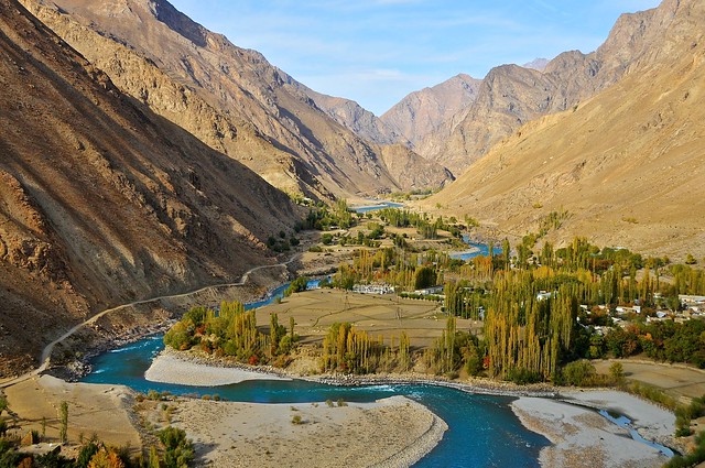
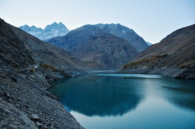
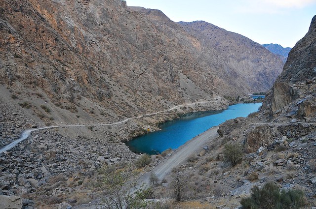
Khorog lies along the northern and southern slopes of the Gunt River, just before it joins the north-south flowing Pyanj river, which forms the border with Afghanistan.The Gunt almost seems bigger than the Pyanj.

The much-hyped, internet infamous, flight from Dushanbe to Khorog


There's a lot of hype out there about the flight between Dushanbe and Khorog, with breathless claims about how dangerous and terrifying it is, and how the plane routinely comes dangerously close to the sides of mountains as it flies between them and not above them. You'll even read about how, despite there not being any crashes involving this flight, there have been instances where the wingtips have actually brushed up against the mountains, dusting the snow off them. That the flight only runs on days when they can confirm at both ends that the weather is clear, and the mountains they fly between clearly visible, only serves to confirm the notoriety of this segment.

But first things first: I had to actually get to the airport in the morning and hope for good weather so the flight could be confirmed. The time printed on the ticket was 6:30, and I figured that it would be a good idea to show up early. You know, like people do in most airports. I thought this would be an especially good idea since I had heard that despite tickets not being sold until the evening before a flight, there were sometimes more tickets sold than seats available if earlier flights had been cancelled due to bad weather.

I took one of the first-running trolley buses from the Farhang to the airport, and made my way to the domestic terminal, which is actually just a large room off to the left of the main terminal, with a separate entrance and a few counters. The terminal was open when I arrived around 5:15, but people were just milling around and they were not waiting for the flight to Khorog. I was pretty sure of this as I didn't see my friend from the day before.

At around 5:45, once the flight those people were assembled for had left, they closed the terminal and kicked me out, making me wait outside. This wasn't that bad, as I fired up my netbook and discovered that the flagship Megafon telecom store, located in the international terminal, had an open wi-fi connection that was extremely fast (a rarity in Central Asia outside of Kazakhstan). I took the opportunity to download a bunch of movies as I waited for things to get cooking.

It wasn't until the actual indicated departure time that people began showing up, and even as they began to gather in the square outside, the terminal still didn't open up. When it did open up the entire check-in process was remarkably relaxed and surprisingly informal. They have a 10 kg weight limit on luggage, and I ended up paying an extra 10 somoni for being a kilogram over. What was more surprising was how many people who showed up who weren't taking the flight, and were also not related to any of the passengers—they were there to ask them to take things to their friends or relatives in Khorog. Obviously this would be a big no-no from a security perspective in the West, and those who buy into the idea that Badakshan is a restive area filled with potential terrorists might also balk at the idea, but my Pamiri friend said that pretty much everyone would agree to do this as it serves an important function in facilitating the transfer of important items. He himself accepted a car part that someone would be waiting for in Khorog. Given the standards of hospitality in the area, none of this should be particularly surprising.

After getting everyone checked in an passing through the rudimentary security, we went out on the tarmac to the plane. You enter at the rear through bomb-bay doors and a little ladder, and inside there are five rows of seats, with single seats on the left of the aisle and benches that seat two (or three) on the right. The seats are little fold-down benches of the sort that might have appeared in cheap post-war cars, but which are more akin to lawn furniture than modern seats. I first picked the first seat on the left, but later asked my Pamiri friend if I could switch with him when I noticed that my window was cracked and scratched and practically impossible to see out of. Since he had taken this flight a number of times, I thought he wouldn't mind, and I was able to get his window seat on the right side.

The seats don't have seat belts—not that it would matter that much—and parents kept their kids in their laps or let them sprawl over the backs of the benches. Again, similar to post-war driving culture, before we cared about things like padded dashes, seat-belts, and car seats for kids, let alone air bags and the like.

_DSC3184
We ended up taking off at about 9:15. This flat agricultural land was just outside Dushanbe.

_DSC3185
The views on the right on the Dushanbe-Khorog leg are meant to be the best, but at this time of year you get a face full of glare from the sun, and hazy views from the smog, making views from the left side much clearer, if less spectacular. In the summer the sun would be much higher and less problematic, and in the later Khorog-Dushanbe flight it would also be less objectionable.

_DSC3187
Nurek Reservoir, formed by a 300 meter high dam—the second-highest in the world.

_DSC3191
Low mountains are already covered with snow. I know they're low because the plane apparently doesn't go above 4,200 meters.

Monday 22 October 2012

Padrud to to Dushanbe

Walking down the valley to Shing

I woke up early in the morning to be on the road by 6:00, which is supposedly when vehicles went down to Penjikent. After waiting by the main road in the darkness with Jumaboy for a while, it became fairly clear that whatever vehicles there were had already left, so I started to walk down the valley in the crisp morning air.

_DSC3075
By 6:45 the sun was up and I was on my way down the valley.

_DSC3076
Everything looks so different in the shade as opposed to the sun.

_DSC3078
Lake 3, with lake 2 behind it.