After wandering around the market perimeter trying to find out where marshrutkas to Jeti Oguz would leave from, I finally found a formal station near the stadium where marshrutkas left from (in the 2014 Lonely Planet it's marked as the Southern Bus Station, but it was unmarked in the 2012 edition).Before getting there I bought some supplies while I was in the market, as I figured the options in Jeti Oguz might be limited. Chocolate bars are a reliable (and compact) source of energy which are easy to take with you when hiking, and I had been buying a lot of them since I was in Kyrgyzstan (and often snacking on randomly instead of keeping them for occasions when I would be away from other food sources).
I caught marshrutka 355 from the Southern Bus Station, which stops in Jet Oguz village and continue all the way along the southern shore of Issy Kul before ending in Kochkor. Jeti Oguz Village is still a good 10 km from the sanatorium where the famous rock formations of broken heart and the seven bulls are located, and I started to walk, figuring I could probably try to hitch along the way. Two other western tourists were on the same marshrutka, and they seemed to have the same idea. Although I started out ahead of them, they soon passed me as I kept stopping to take pictures, and they were hitched a ride after a kilometer or so of walking. As both the weather and the views were nice, I decided to keep walking.

Although there is accommodation available in the Soviet-era sanatorium, it was pricey and institutional, and I had hoped to avoid it. I had figured that simply by walking around the village as a foreigner, I would probably be approached by a private citizen offering a place to stay, as this is basically what happens with yurt-stays, and even though there were no yurts in town I figured something similar would happen in this tourism-oriented village.
I walked around a bit, but wasn't approached, so I stopped by one of the stores that are on the left as you enter the village to grab a drink and some ice cream before going further into the village. To my relief, the store owner asked me if I needed a place to stay, and said he had a place I could stay at. I figured it would be a bed/room at his home, but he showed me to an apartment in a rather incongruous Soviet-style apartment block in the village, where I would be the only person in the entire apartment! And the price? 250 som per night. The kicker was that there was even an old and stained bathtub: I hadn't had a bath since I left California, but I certainly would that night, rusty bathtub or not.
That evening I luxuriated in the bath. OK, it was a bit grotty and I had to use a sock as a stopper, but a bath is a bath, and so long as the water is hot enough there's never such a thing as a bad bath. Although the apartment had a kitchen (and a TV and DVD player), it didn't really even have much in the way of basics like sugar, salt, or tea. I think I just made some ramen noodles for dinner, and ate some of the frosted flakes I had bought in Kochkor as I relaxed. As I kind of predicted before my trip, having a computer isn't great for productivity. I stayed up to late watching a movie on my netbook and ended up getting a much later start than I should have the next day. In a place like Karakol or Bishkek, where there's not a lot to do, late starts aren't so bad. But in a place where you can actually be doing cool stuff from as soon as you get up, it's terrible. I should have stayed on Beijing time.
The picture above was about 10 minutes before sunset. Twilight would last another half an hour after that, but the overcast skies meant the light faded fast and that the full moon would provide little illumination. I started to backtrack, and then noticed that there was a highly worn trail leading down the hill, but in the direction of the sanatorium as opposed to back towards the valley of the flowers. This looked like a good shortcut, and given the rapidly dying light, I was in need of one.
The shortcut started promisingly, but soon got messy, as it traversed a steep grassy section that was strangely boggy, as water seemed to be seeping out of the ground. I had to hep between stones (one of my boots had a tear which would leak water) to get across it staying dry. More distressingly, the path started to become a little less worn, though it was still strong. At the end of the grassy area the path plunged into the woods. I followed it in, but after a hundred meters or so it became apparent that this wasn't a trail to anywhere, and that it was just some weird goat trail that suddenly broke up because there's nowhere for goats to go in the forest. Fuck.
At this point, however, I was committed to this path. It was well after sunset, and there was no going back. Heck, it would be tough to even find the main goat track that led me into the woods, given the light available. I was going to have to scramble down the mountain until I reached the valley. This was easier said than done, as the trees were surprisingly thick and the slopes rocky and unpredictable. In patches there were steep rocky slopes, sometimes covered in deep moss. I slid and scrambled down on my hands, feet, and ass, sometimes grabbing tree trunks as I slid to break my descent. I cam to a section that carries a mountainside stream, and had to cross to the other side and climb down a steep boulder-strewn slope.
I knew I was in trouble. I knew that I had to move, and move fast in the little light that was still available. Slowing down and thinking would not be a good idea. Worrying about bumps, bruises, and the risks of minor slips and falls was a luxury I couldn't afford, and thankfully the adrenaline pumping through me meant I wouldn't feel them, anyway. I don't think I was afraid of dying, but I knew it was a real possibility if I didn't move fast: spending the night up there would have been catastrophic.
I eventually made it to the bottom, only to realize that the road was on the opposite side of the river, and that there was nowhere for me to walk since the mountain sloped down straight into the river without any real river-bank. I had to guess on where the closest bridge would be, and thankfully my guess that I should go upstream was a good one, as it was only about 100 meters of scrambling before I reached the bridge. Phew.
Once I had made is safely to the road, and was objectively safe, I think that the adrenaline to a certain extent faded (but not really, since I was really warm all the way back to the base) and my fear was allowed to manifest itself in other ways. It was pitch dark, and I could barely see anything except by using my camera's LCD screen as a flashlight. So of course, in this context, I was suddenly afraid that I was being stalked by a big cat—a mountain lion or a bobcat or something like that. Of course. I didn't even know if Kyrgyzstan has any of these, and if they did I'm sure sheep are a much easier target, but I needed to manufacture something to be afraid of, no matter how implausible (and despite knowing that there may be some wolves in Kyrgyzstan, I really wouldn't be afraid of wolves since there are basically no records of wolves in Canada ever attacking people). So as I walked down the path I would turn around every so often the make sure that I wasn't being stalked, or that my stalker knew I was on the lookout. It was a bizarre thought process, and although I was fully aware of how bizarre it was I was helpless to stop thinking that way. The paranoia only faded as I approached the village, where any even my paranoia couldn't convince me that a mountain lion would continue to stalk me.
I didn't arrive back in the sanatorium village until about an hour after dark. I stopped in the store to get some food to cook —potatoes, and eggs, and some ramen noodles—and the lady there asked if I had seen any cars going up the hill as I came down. I said I hadn't, and she was surprised because her husband had been worried that I wasn't back after dark, and had gone to look for me. I played it off like I had just decided to stay up there for a bit longer, instead of admitting I had just about killed myself, but I figure that's pretty basic human nature.
The next morning I woke up to rain, which was snow in the higher elevations. If I was lucky, I would have been snowed in had I been stuck on the mountain, and if I was unlucky I would have been rained in. Either way, it wouldn't have been pretty.
While in Karakol and Jeti Oguz I had considered heading to Kochkor to do a short horse trek into the nearby mountains, or taking the Suusamyr valley on my way back to Bishkek (although lake Song Kul is a popular destination, I wasn't that interested in seeing it as it sounded like a fairly boring high-altitude lake in the middle of grasslands, and more mountainous grasslands had more appeal to me). But given the rain and the inexorable march of time, I though it would be better to head back to BIshkek and get a move on to Tajikistan without any more delay.
In retrospect, had the weather held up it would have been nice to spend more time in Jeti Oguz, and possibly to have done a multi-day trek from there over to the Karakol valley, as described in Lonely Planet and outlined as part of the trek described here. In general, I think that budget and indepdent tour agencies can be a great source of information about what sorts of trips and itineraries are possible and interesting, even if you don't end up booking a tour with them. Although an independent traveler will likely have to budget in extra time if they want to take public transport and arrange things on their own, it can be very helpful to take a look at what the agencies do: from reading guidebooks it's very evident that a lot of what LP does is simply crib the suggestions from established tours.
September 29, Jeti Oguz: 510 som
I caught marshrutka 355 from the Southern Bus Station, which stops in Jet Oguz village and continue all the way along the southern shore of Issy Kul before ending in Kochkor. Jeti Oguz Village is still a good 10 km from the sanatorium where the famous rock formations of broken heart and the seven bulls are located, and I started to walk, figuring I could probably try to hitch along the way. Two other western tourists were on the same marshrutka, and they seemed to have the same idea. Although I started out ahead of them, they soon passed me as I kept stopping to take pictures, and they were hitched a ride after a kilometer or so of walking. As both the weather and the views were nice, I decided to keep walking.
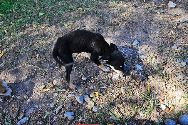 |
| Not far from the village, I came across a couple of super-skinny little puppies by the side of the road. |
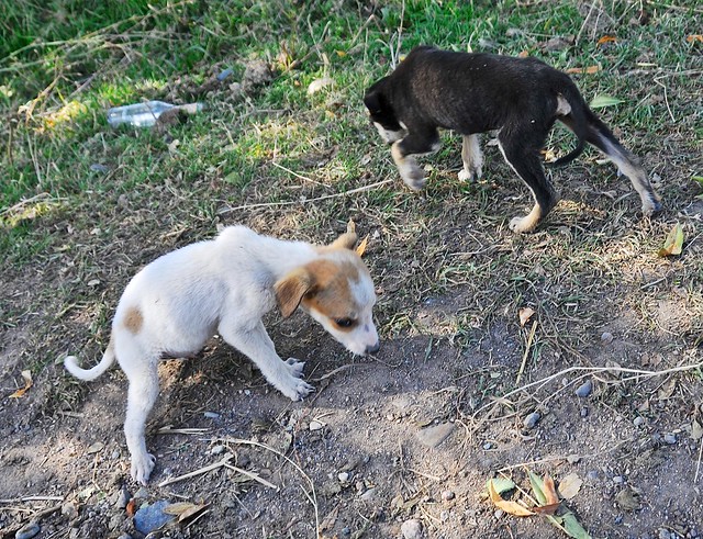 |
| I fed them the sausage I had been carrying around since I saw that starving kitten in Pingyao. They were so unused to people they bit my fingers, too. |
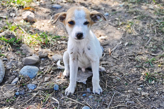 |
| I hope they survived. |
 |
| View to the west. |
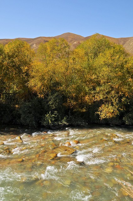 |
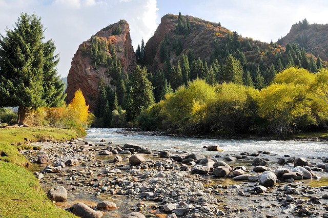
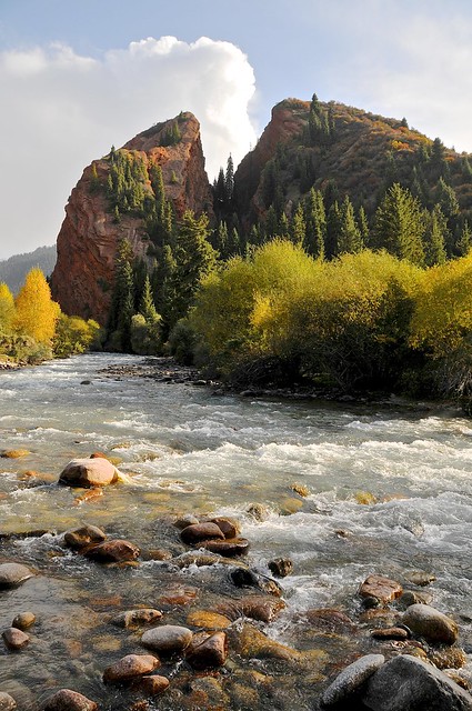
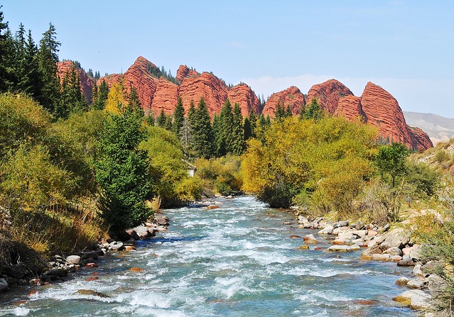
| The Jeti Oguz river. |
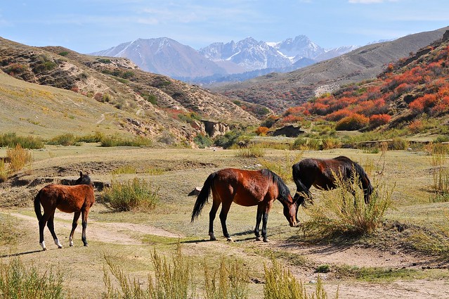 |
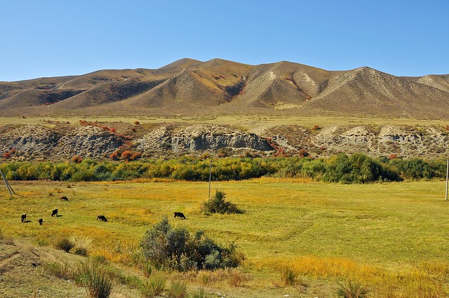
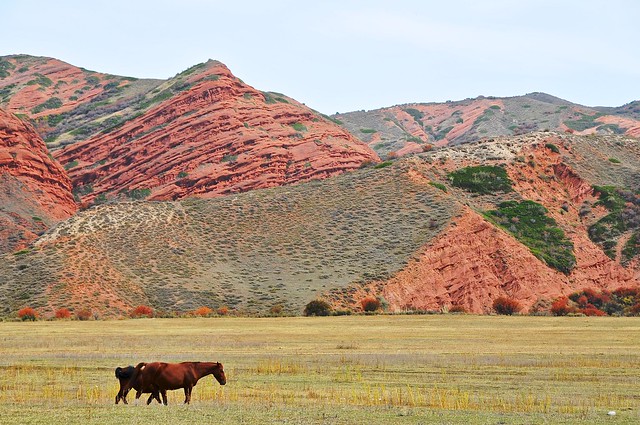
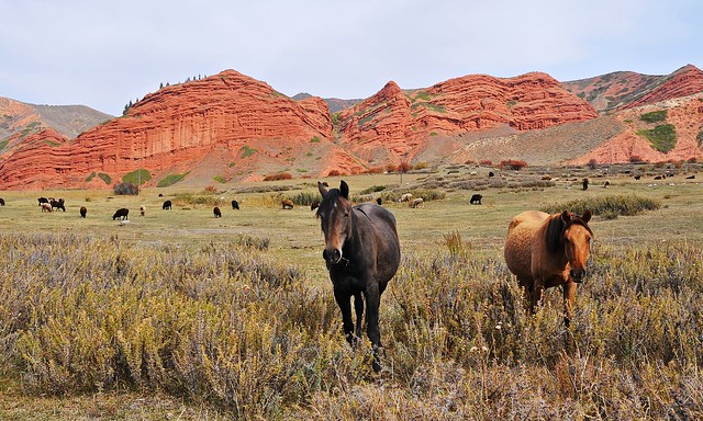
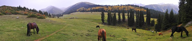
| View to the east. There were lots of horses in the valley. Probably more horses than cows. |
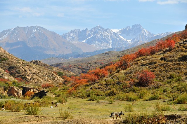 |
| This dog was helping his master round up horses. |
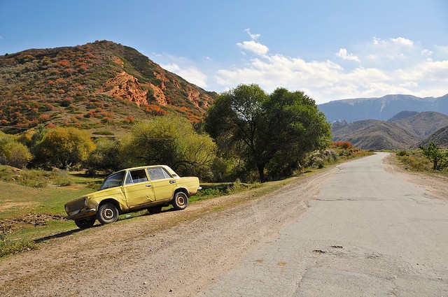 |
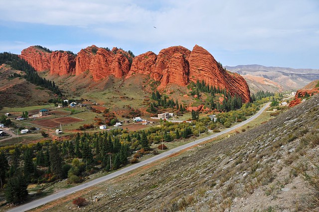
| This old Lada was just sitting by the road, no driver in sight. You can see the mountain behind it begin to get red. |
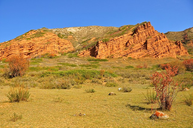 |
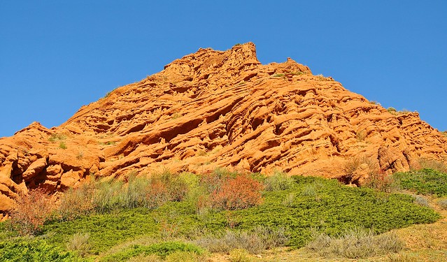
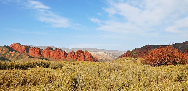
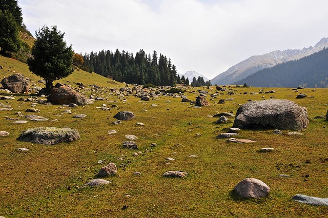
| The red rocks of the valley. |
 |
| I started to follow a trail on the eastern side of the road. |
 |
| Looking north up the valley. |
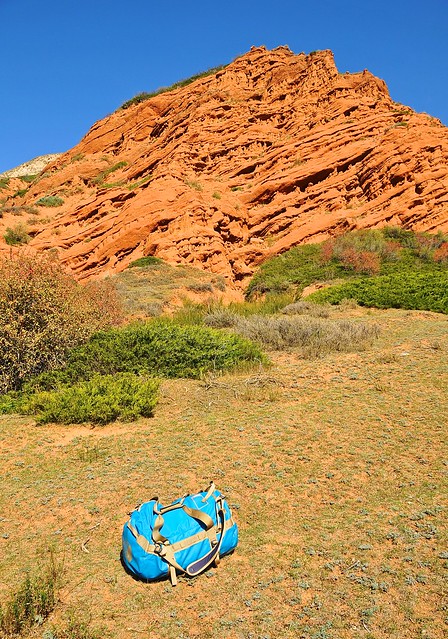 |
| It would have been a lot easier if I wasn't carrying that darn bag. |
 |
| The first glimpse of "Broken Heart," as that cleft in the mountain is known. |
 |
| Looking up the hill. |
 |
| I decided to try and scramble up the mountain ridge to the left. There were trails that started up the hill, but they involved beating through bushes and trees before they petered out at the base of steep and scrabbly slopes that were so unstable you had to crawl up them lest your footholds give way. It was a stupid way to ascend, but once I was half way up I wasn't going to back down because I'm dumb like that. |
 |
| The views from the top were pretty nice, though. |
 |
| Looks more like a broken heart from this angle. |
 |
| A mini-jailoo. |
 |
| The scramble down was much easier, mainly because I could pick an easy path instead of simply picking a blind path and having to accept where it led me, as happened on the way up. |
 |
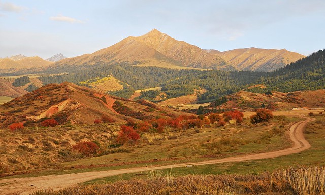
| This sort of landscape actually looks like it could come from home (except for the red rocks). |
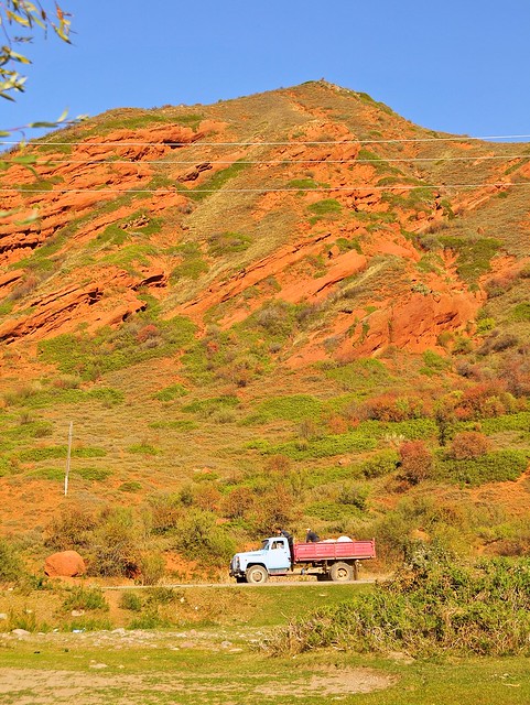 |
| Typical Kyrgyz work truck trundles past Broken Heart. |
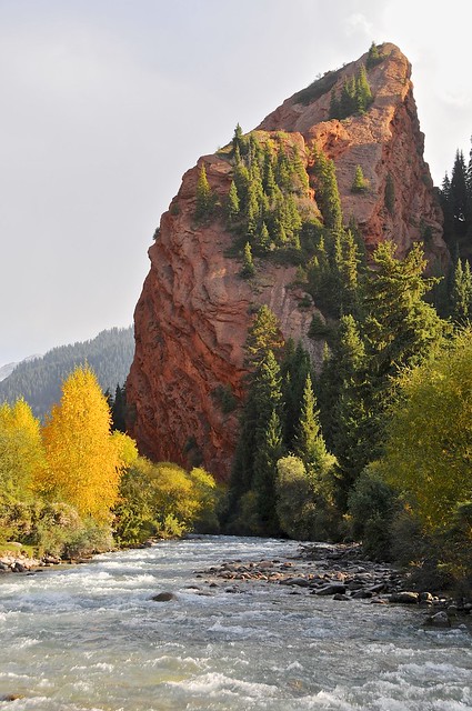 |
| There's some sort of terrible "half-hearted" pun just begging to be used here. |
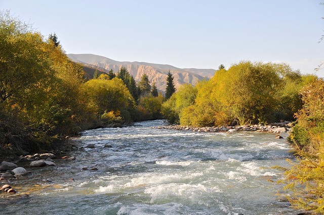 |
| The Jeti Oguz river |
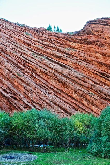 |
| The rock striations on from the eastern shadows of Broken Heart. |
Although there is accommodation available in the Soviet-era sanatorium, it was pricey and institutional, and I had hoped to avoid it. I had figured that simply by walking around the village as a foreigner, I would probably be approached by a private citizen offering a place to stay, as this is basically what happens with yurt-stays, and even though there were no yurts in town I figured something similar would happen in this tourism-oriented village.
I walked around a bit, but wasn't approached, so I stopped by one of the stores that are on the left as you enter the village to grab a drink and some ice cream before going further into the village. To my relief, the store owner asked me if I needed a place to stay, and said he had a place I could stay at. I figured it would be a bed/room at his home, but he showed me to an apartment in a rather incongruous Soviet-style apartment block in the village, where I would be the only person in the entire apartment! And the price? 250 som per night. The kicker was that there was even an old and stained bathtub: I hadn't had a bath since I left California, but I certainly would that night, rusty bathtub or not.
 |
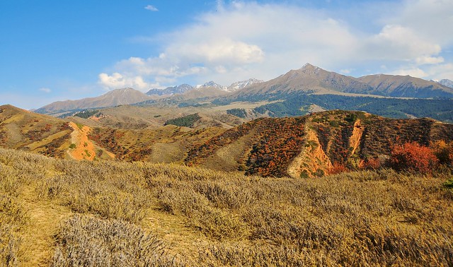
| There was a bumpy dirt road behind the store that led up the ridge to the east of the village. At the top there's a small plateau offering views over the village, red mountains to the north, and the mountains to the east. |
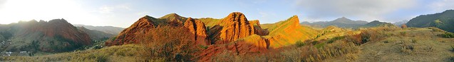 |
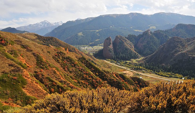
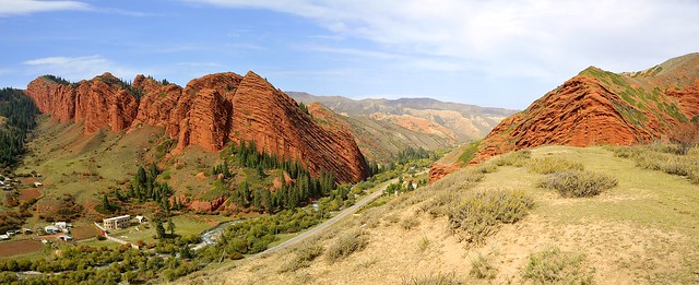
| The opposite side of Broken Heart forms the Seven Bulls (the two bulls on the right are the two halves of the Broken Heart when viewed from the back), which you can see to the left. On this side of the valley are another set of impressive red mountains, and views over the eastern valley peaks to the right. |
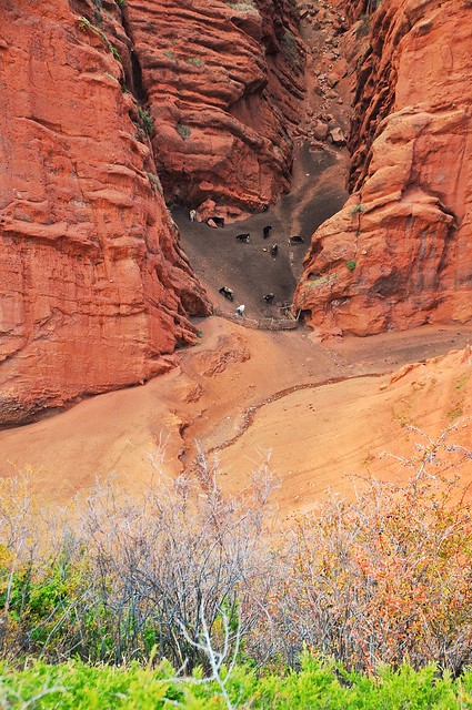 |
| A mini canyon in the side of the mountain was used as a cattle pen. |
 |
| Looking east over the plateau. |
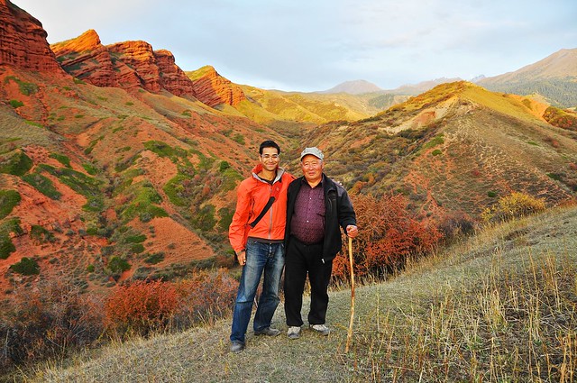 |
| The shop-keeper and his friend (pictured here) drove up the ridge to tell me that someone had seen a Ibex up here, and to see if they could spot it for me. We weren't able to find it. |
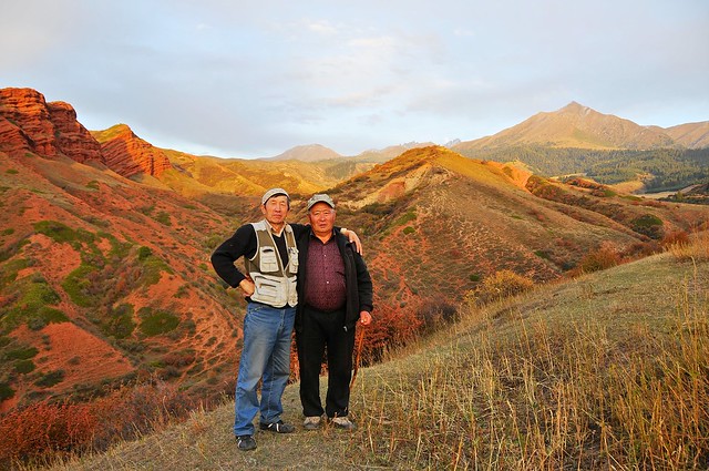 |
| Shopkeeper on the left (although his skullcap looks Uzbek, he's actually Kyrgyz). It must be the Soviet/Russian influence that makes locals posed in dramatic or theatrical ways. It's a pretty good pose, though. |
 |
| Moonrise in the east. |
 |
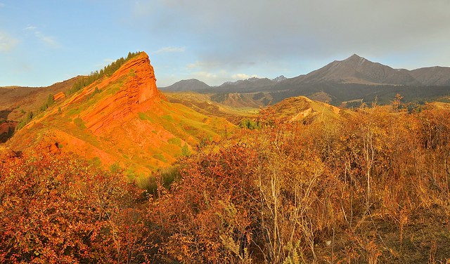
| The setting sun makes everything so red it looks fake. |
 |
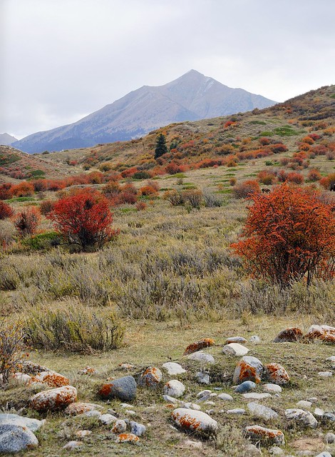
| Pretty little peak. |
That evening I luxuriated in the bath. OK, it was a bit grotty and I had to use a sock as a stopper, but a bath is a bath, and so long as the water is hot enough there's never such a thing as a bad bath. Although the apartment had a kitchen (and a TV and DVD player), it didn't really even have much in the way of basics like sugar, salt, or tea. I think I just made some ramen noodles for dinner, and ate some of the frosted flakes I had bought in Kochkor as I relaxed. As I kind of predicted before my trip, having a computer isn't great for productivity. I stayed up to late watching a movie on my netbook and ended up getting a much later start than I should have the next day. In a place like Karakol or Bishkek, where there's not a lot to do, late starts aren't so bad. But in a place where you can actually be doing cool stuff from as soon as you get up, it's terrible. I should have stayed on Beijing time.
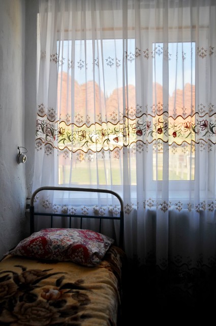 |
| This was the view I was greeted with the next morning. I think I got my money's worth. (This kind of lacy window covering and floral blankets are very Russian, as are the ubiquitous floral tableclothes under clear plastic.) |
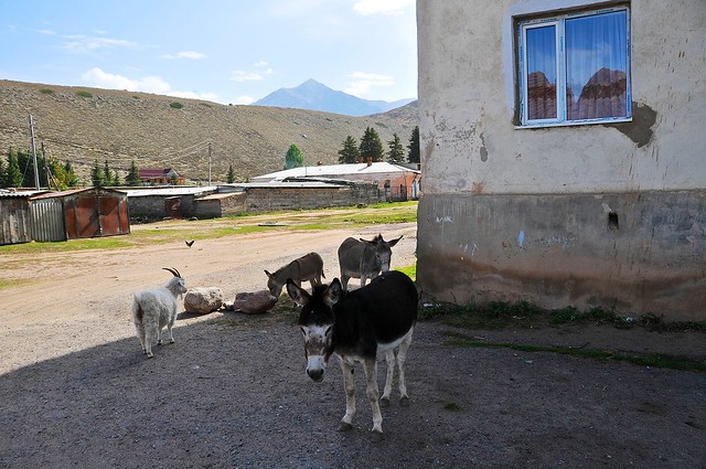 |
| My room from the outside, with a coterie of goats and donkeys. |
 |
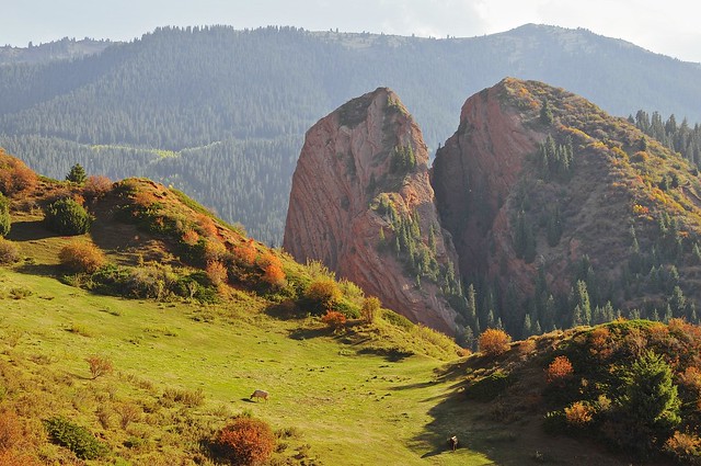
| Turn myself around, and you have the Bulls. I count more than seven, but no matter. |
 |
| Climbing the ridge behind the shop. My apartment would be just off to the left on the village opposite. |
 |
| Seven Bulls and matching mountains on the east. |
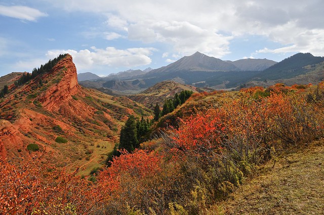 |
| In the sun, everything looks way redder than it should. |
 |
| The overcast tones things down a bit. |
 |
| Curious horses come to say hello. |
 |
| The overcast and the colourful foliage makes it look really cold in this picture, but it was actually quite nice. |
 |
| Looking north from the southern edge of the plateau. |
 |
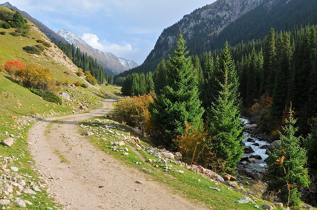
| Back down from the plateau, the road up to the valley of flowers follows the river. |
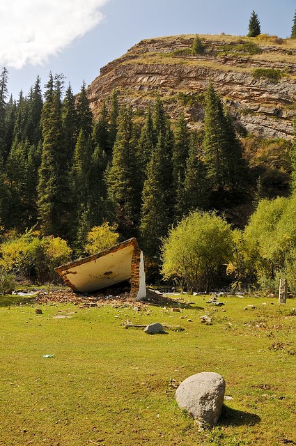 |
| An abandoned structure. I'm always curious when I see what appear to have been sturdy and functional buildings abandoned and destroyed, especially when they look like they must have been better than buildings that still exist and are in use. There must be some sort of story behind them. |
 |
| Little wooden bridges cross the river, as the dirt road winds up the valley. |
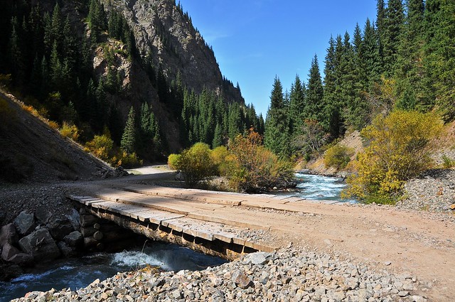 |
| Typical bridge. Note how the mountain slopes down straight into the river on the side without the road. |
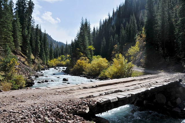 |
| The road criss-crosses from one side of the river to the other as space allows. |
 |
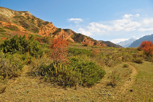
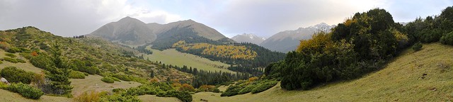
| A few kilometers from the sanatorium village the valley opens up into the valley of the flowers. Apparently in the spring the valley is red with poppies. |
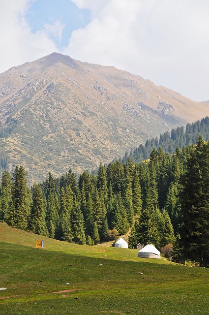 |
| A couple of yurts in the jailoo, with the outhouse on the left. |
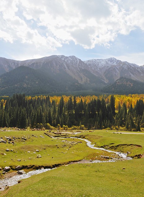 |
| A stream runs through the pastures, with yellowing conifers in the background. |
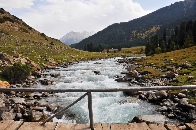 |
| This bridge has a railing. What's up with that? |
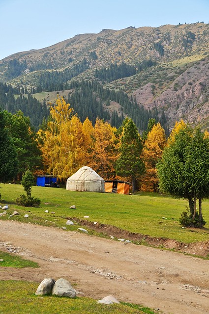 |
| A yurt restaurant, by the looks of it. |
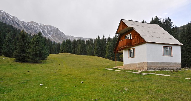 |
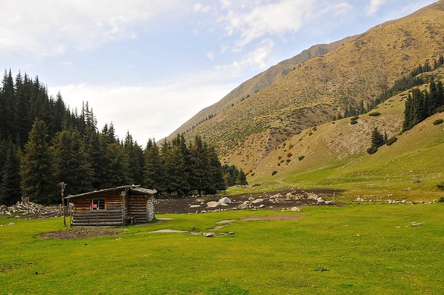
| A tourist cabin in the western edge of the valley of flowers. |
 |
| Supposedly there is a waterfall somewhere up here. |
 |
| I just saw lots of trees, and headed back down the valley when I wasn't able to find anything other than trees and wet, boggy ground. |
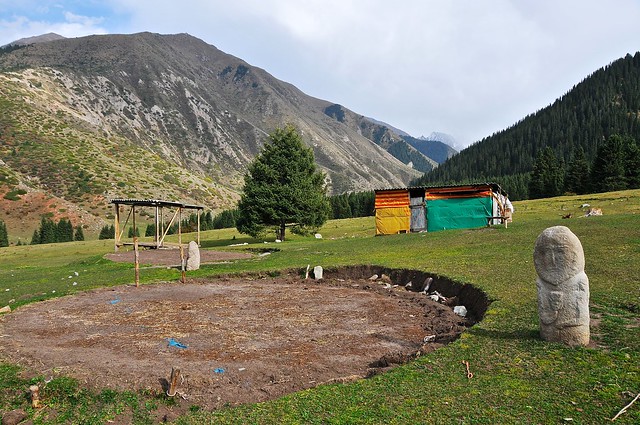 |
| Back in the valley you can see where yurts were set up earlier in the season, right next to a balbal. |
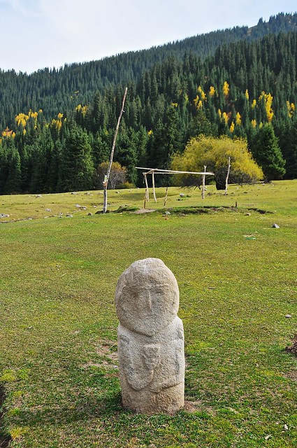 |
| This balbal looks amazingly well preserved. |
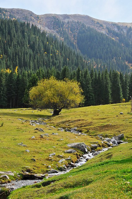 |
| Tree in the jailoo. |
 |
| View across the jailoo. |
 |
| Heading north out of the valley of flowers. |
 |
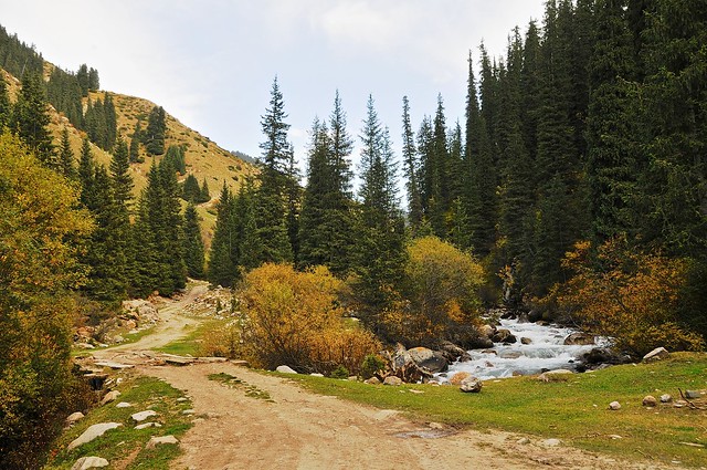
| Whitewater in the river. |
 |
| Road to up the valley to Telety. |
 |
| The valley widens, allowing space for a livestock pen. |
 |
| The trampled earth shows evidence of heavy use. I suspect the fear of wolves means they keep a much sharper eye on their herds than the Mongolians do. |
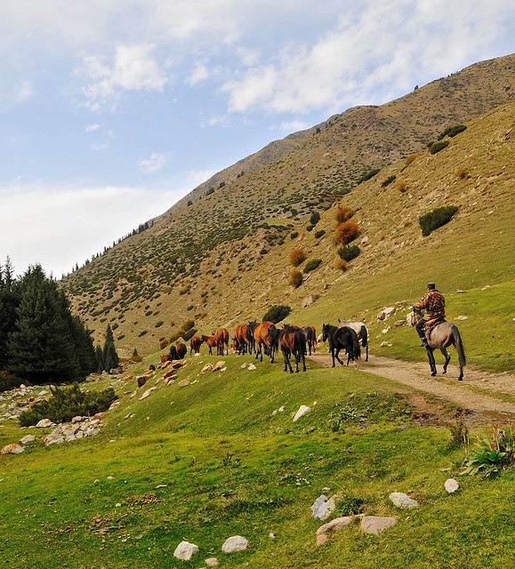 |
| Herder bringing horses down to lower ground. |
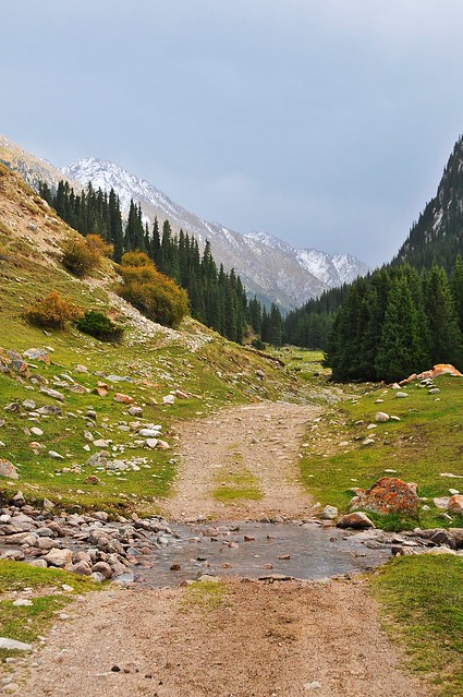 |
| A stream crosses the road. I even saw this sort of stream crossing on the the recently rebuilt section of M41 between Osh and Sary Tash. |
 |
| On the way back down the valley. |
 |
| Getting back to the valley of flowers. |
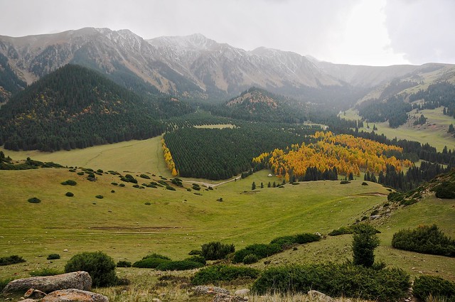 |
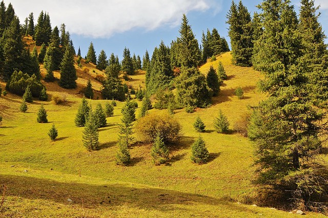
| Climbing the valley to the east of the valley of flowers, you can clearly see that the forest there is the result of tree planting. I'm not quite sure why, but no doubt the Soviets had a great reason for turning productive pastures into a pine forest. |
 |
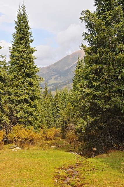
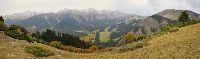
| Looking east up the valley. |
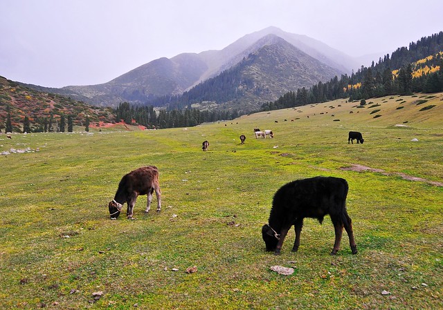 |
| Cute little calves. |
 |
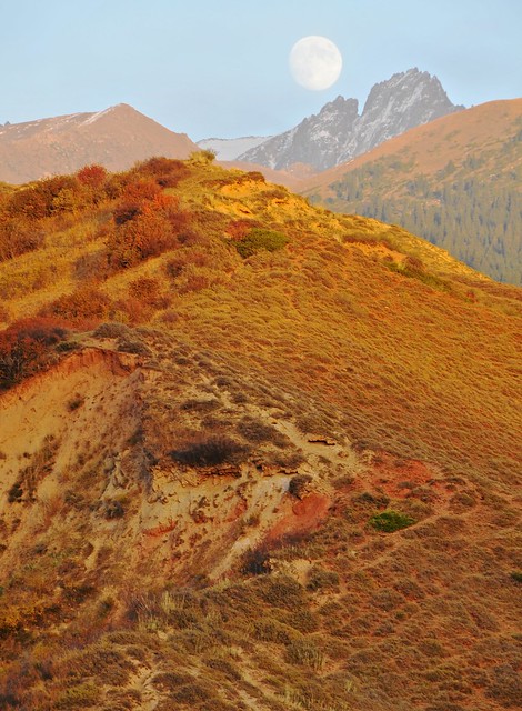
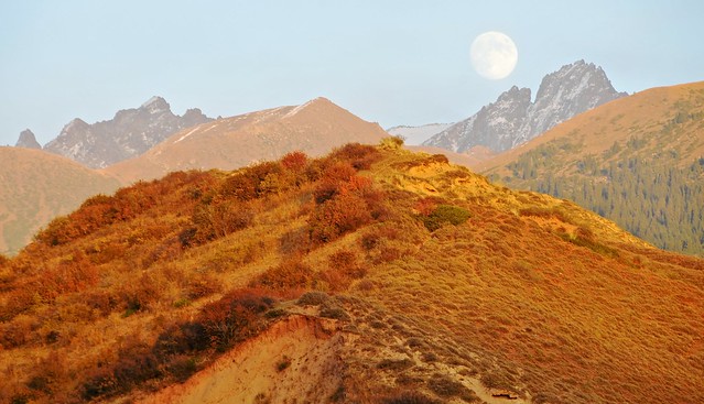
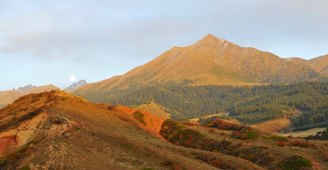
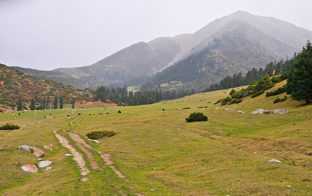
| There's a strong impulse to keep going uphill, especially when there's a well-trodden path, even though I knew I didn't have much daylight left (you can always retrace your steps in the dark, right?). This impulse was especially strong since this path turned north, towards to sanatorium. |
 |
| 10 minutes later: higher up and further north. |
 |
| Looking down towards the valley of the flowers. |
 |
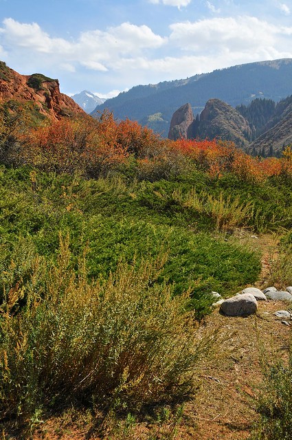
| Walking along a goat trail on the mountain. The the left of the ridge you can see the seven bulls in the distance. I probably could have skirted the right-hand side of the mountain and ended up in the plateau where I started the day, but it was getting dark fast and I thought a quick descent to the road would be better. |
The picture above was about 10 minutes before sunset. Twilight would last another half an hour after that, but the overcast skies meant the light faded fast and that the full moon would provide little illumination. I started to backtrack, and then noticed that there was a highly worn trail leading down the hill, but in the direction of the sanatorium as opposed to back towards the valley of the flowers. This looked like a good shortcut, and given the rapidly dying light, I was in need of one.
The shortcut started promisingly, but soon got messy, as it traversed a steep grassy section that was strangely boggy, as water seemed to be seeping out of the ground. I had to hep between stones (one of my boots had a tear which would leak water) to get across it staying dry. More distressingly, the path started to become a little less worn, though it was still strong. At the end of the grassy area the path plunged into the woods. I followed it in, but after a hundred meters or so it became apparent that this wasn't a trail to anywhere, and that it was just some weird goat trail that suddenly broke up because there's nowhere for goats to go in the forest. Fuck.
At this point, however, I was committed to this path. It was well after sunset, and there was no going back. Heck, it would be tough to even find the main goat track that led me into the woods, given the light available. I was going to have to scramble down the mountain until I reached the valley. This was easier said than done, as the trees were surprisingly thick and the slopes rocky and unpredictable. In patches there were steep rocky slopes, sometimes covered in deep moss. I slid and scrambled down on my hands, feet, and ass, sometimes grabbing tree trunks as I slid to break my descent. I cam to a section that carries a mountainside stream, and had to cross to the other side and climb down a steep boulder-strewn slope.
I knew I was in trouble. I knew that I had to move, and move fast in the little light that was still available. Slowing down and thinking would not be a good idea. Worrying about bumps, bruises, and the risks of minor slips and falls was a luxury I couldn't afford, and thankfully the adrenaline pumping through me meant I wouldn't feel them, anyway. I don't think I was afraid of dying, but I knew it was a real possibility if I didn't move fast: spending the night up there would have been catastrophic.
I eventually made it to the bottom, only to realize that the road was on the opposite side of the river, and that there was nowhere for me to walk since the mountain sloped down straight into the river without any real river-bank. I had to guess on where the closest bridge would be, and thankfully my guess that I should go upstream was a good one, as it was only about 100 meters of scrambling before I reached the bridge. Phew.
Once I had made is safely to the road, and was objectively safe, I think that the adrenaline to a certain extent faded (but not really, since I was really warm all the way back to the base) and my fear was allowed to manifest itself in other ways. It was pitch dark, and I could barely see anything except by using my camera's LCD screen as a flashlight. So of course, in this context, I was suddenly afraid that I was being stalked by a big cat—a mountain lion or a bobcat or something like that. Of course. I didn't even know if Kyrgyzstan has any of these, and if they did I'm sure sheep are a much easier target, but I needed to manufacture something to be afraid of, no matter how implausible (and despite knowing that there may be some wolves in Kyrgyzstan, I really wouldn't be afraid of wolves since there are basically no records of wolves in Canada ever attacking people). So as I walked down the path I would turn around every so often the make sure that I wasn't being stalked, or that my stalker knew I was on the lookout. It was a bizarre thought process, and although I was fully aware of how bizarre it was I was helpless to stop thinking that way. The paranoia only faded as I approached the village, where any even my paranoia couldn't convince me that a mountain lion would continue to stalk me.
I didn't arrive back in the sanatorium village until about an hour after dark. I stopped in the store to get some food to cook —potatoes, and eggs, and some ramen noodles—and the lady there asked if I had seen any cars going up the hill as I came down. I said I hadn't, and she was surprised because her husband had been worried that I wasn't back after dark, and had gone to look for me. I played it off like I had just decided to stay up there for a bit longer, instead of admitting I had just about killed myself, but I figure that's pretty basic human nature.
The next morning I woke up to rain, which was snow in the higher elevations. If I was lucky, I would have been snowed in had I been stuck on the mountain, and if I was unlucky I would have been rained in. Either way, it wouldn't have been pretty.
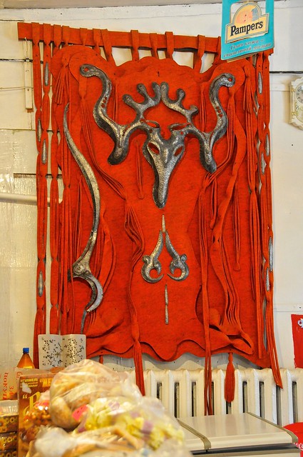 |
| Interesting leather and metal wall decoration above the freezer. See this, and you're in the right shop. |
While in Karakol and Jeti Oguz I had considered heading to Kochkor to do a short horse trek into the nearby mountains, or taking the Suusamyr valley on my way back to Bishkek (although lake Song Kul is a popular destination, I wasn't that interested in seeing it as it sounded like a fairly boring high-altitude lake in the middle of grasslands, and more mountainous grasslands had more appeal to me). But given the rain and the inexorable march of time, I though it would be better to head back to BIshkek and get a move on to Tajikistan without any more delay.
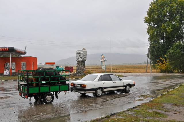 |
| You don't see many Audis` towing trailers with cows in them back home (and I'm from cattle country). |
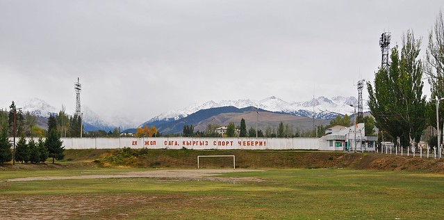 |
| Back in Karakol and the nearby hills and mountains are much snowier. |
In retrospect, had the weather held up it would have been nice to spend more time in Jeti Oguz, and possibly to have done a multi-day trek from there over to the Karakol valley, as described in Lonely Planet and outlined as part of the trek described here. In general, I think that budget and indepdent tour agencies can be a great source of information about what sorts of trips and itineraries are possible and interesting, even if you don't end up booking a tour with them. Although an independent traveler will likely have to budget in extra time if they want to take public transport and arrange things on their own, it can be very helpful to take a look at what the agencies do: from reading guidebooks it's very evident that a lot of what LP does is simply crib the suggestions from established tours.
Budget
September 28, 2012, from Karakol to Jeti Oguz: 490 som- Snickers 3-pack and cereal: 135 som
- Marshrutka #355 to town of Jeti Oguz (continues to Kochkor): 30 som
- Entire apartment: 250 som
- Coke: 40 som
- Apples: 35 som
September 29, Jeti Oguz: 510 som
- Entire apartment: 250 som
- 1.5 liter coke, bread, super snickers: 140 som
- Coke, potatoes, 5 eggs, ramen: 120 som
No comments:
Post a Comment